
Sarba features the remnants of a mysterious temple that dates back to antiquity.
Toponym
The designation “Sarba” takes several propositions by travelers and scholars:
Sarba’s old designation might be “Srb” that derives from “Srp” which refers to “Serapls” or “Serapeum”. It relates to a religious edifice dedicated to the syncretic Greco-Egyptian deity Serapis. Some scholars suggest that Serapis was venerated at this location, while others suggest that the Greek god Zeus was the holder of the temple based on a fragment found on site that held an inscription dedicated to Zeus-Epouranios.
“Palœbyblos” is also a possible designation of Sarba when relying on data from the Peutinger map (ancient Roman road map) and mentioned by Strabon (Greek geographer).
“Kalaat Sarba” is a designation mentioned by Dussaud (French archaeologist) who proposed that the site was the location of the crusader fortress Sorbe.
“Deir El Mkhaless” (the Monsatery of the Savior) is the current name of the site which saw the construction of the Greek-Catholic monastery in the 19th century.
Timeline
1st millennium BC – the site most likely witnessed the development of a small Phoenician era settlement. Scholars based their theory on little remains housed within the monastery and from remnants recorded by travelers that testify to a significant human occupation since antiquity.
1st century BC – 3rd century AD – Under Roman rule, a temple was erected probably on top of an earlier structure that dates back to the late Hellenistic era.
4th century AD – It is possible that the edifice was converted into a church during the Byzantine era like many other temples around Lebanon.
12th century AD – A medieval era fortress was erected on top of the temple, probably by the Crusaders.
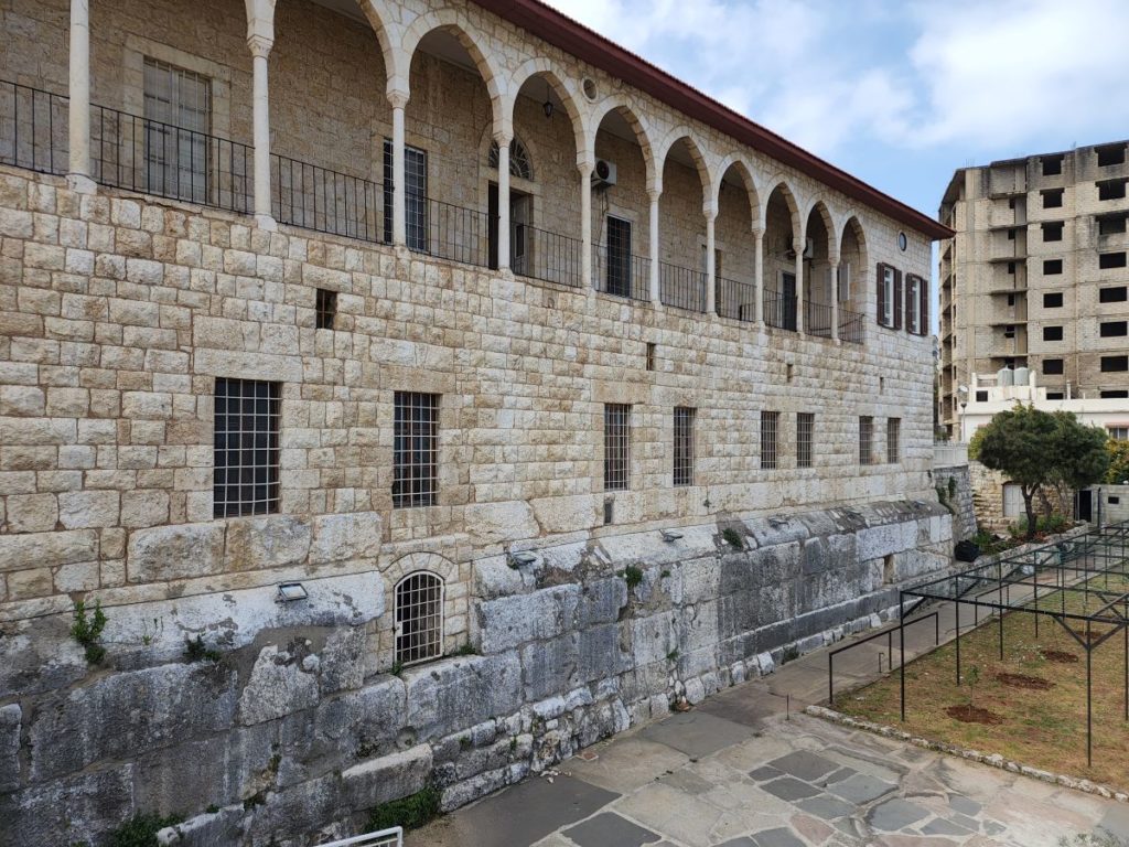
19th century AD – the Greek-Catholic Saint-Sauveur monastery was built on the ruins of the fortress by using its stones and other fragments of the temple.
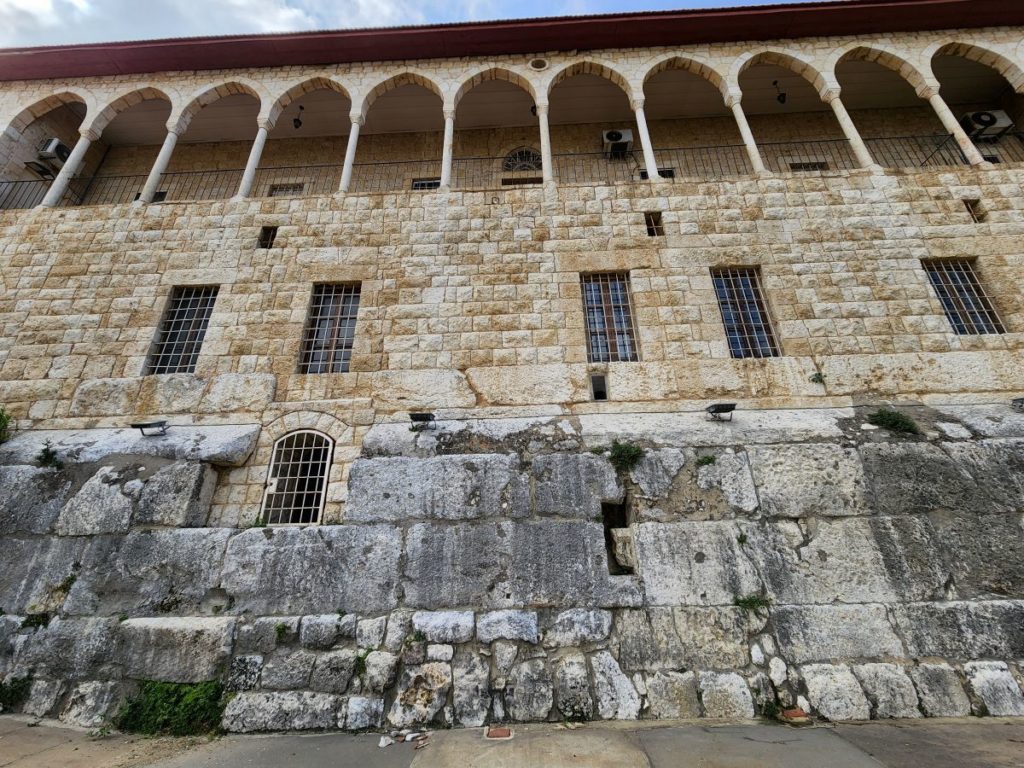
Structure
What is visible of the temple today represents the base of the podium. Before the construction of the monastery, travelers from the 18th century described the remnants of the temple:
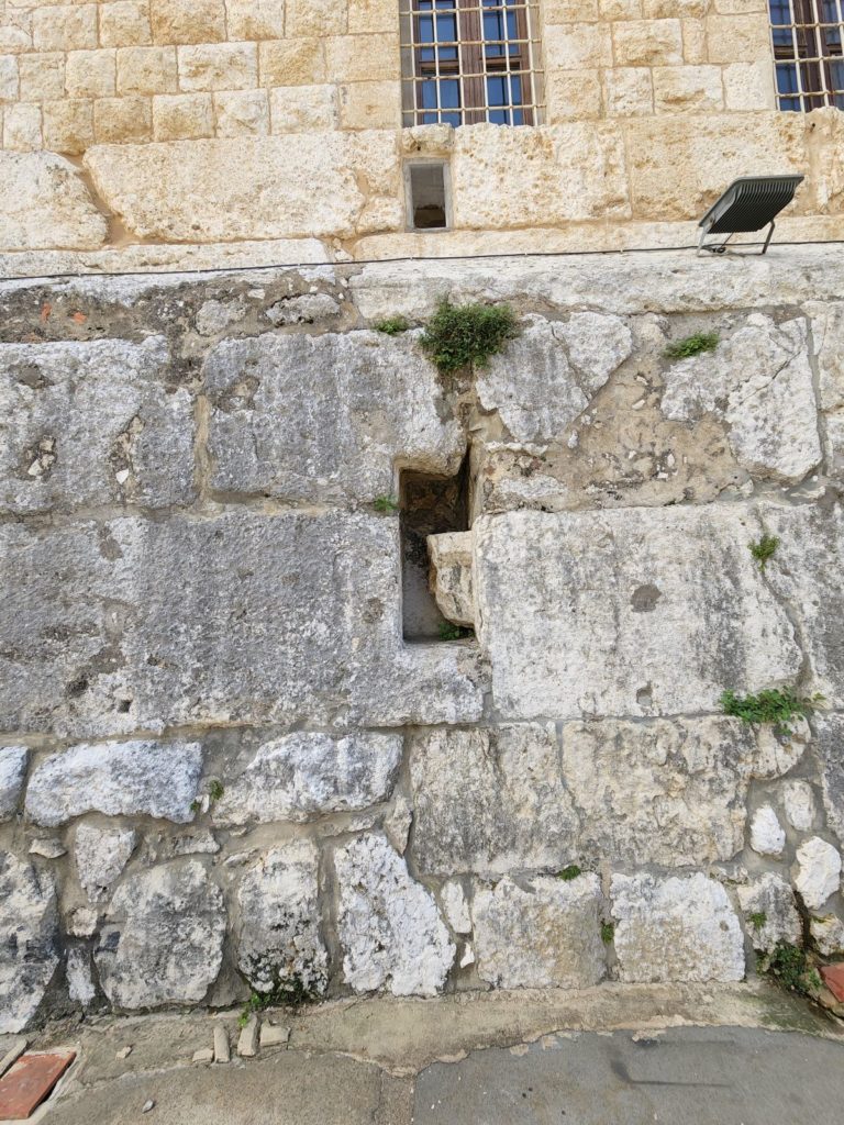
Measuring approximately 28mx15m, the structure is a rectangular flat shaped edifice that held a paved podium with large, carefully cut stones. Bordered by a cornice which is no longer visible, it consists of two superimposed blocks of masonry which can be seen on the western side of the site.
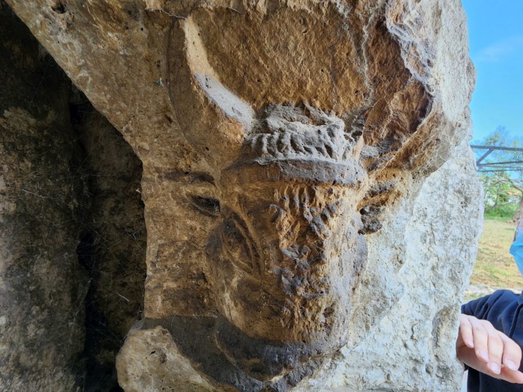
The masonry features an irregular shaped niche that bears the sculpted head of a heifer looking towards the left wall of the niche, remaining invisible from the front. Some scholars propose that this relief represents a talisman that protects the venerated God of the temple.
The absence of a doorway, stairs and other structural elements that are found in most of the temples in Lebanon led some scholars to suggest that this structure might actually be a mastaba, a type of ancient Egyptian tomb in the form of a flat-roofed, rectangular structure with inward sloping sides. Further studies may reveal the identity of this structure.
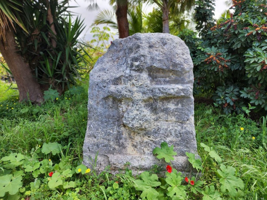
Several fragments were discovered on site and are found in the premises of the monastery and some inaccessible rooms for the public, such as:
A fragment of a large cornice which is believed to date back to the Hellesntic era (located in a garden on the northern side of the monastery).
Two fragments of columns with its bases (located around the main garden of the monastery).
A fragment of a small cornice in white stone, and two portions of small pediments, of Greek architecture, one of which bears a head of Apollo (inaccessible room).
A fragment of stone bearing a Latin inscription of unknownmeaning (inaccessible room).
Additional attractions can be noticed near the site, such as El Batieh Site and Sarba Sebil.
Karim Sokhn
Tour Operator and Tour Guide
References:
Mission de Phénicie, Ernest Renan.
Julien Aliquot, La vie religieuse au Liban sous l’Empire Romain, Julient Aliquot, 2009.
LE MONUMENT DE SARBA (Djouni de Phénicie) ET LE SITE DE PALÆBYBLOS Author(s): Georges Colonna Ceccaldi.