Majdel-Anjar village houses a massive Roman temple that date back the early Roman era. It is one of the biggest temples located in West Bekaa.
Location
The temple is located on an isolated tell, West of the modern village and south of the modern road from Beirut to Damascus.
Toponym
En-Na-Ga-Ra – The earliest mention of the toponym ain al-jarr, name of modern Majdel-Anjar and Anjar, dates back to the 12th century BC. The scholar W.F. Albright believes to have found this toponym in Egyptian transcription “En-Na-Ga-Ra” on the list of Ramses III at the great temple of Medinet Habu, in Egypt.
Gerrha – The name Gerrha is mentioned by the Greek historian Polybius in the context of the wars which opposed Antiochos III and Ptolemy IV around 219 BCE. The toponym Gerrha is identified with Anjar since the names Gerhaa and Ain al-jarr are similar.
Ain Jara – Ain Jara was the name given to the city location around the 8th century AD under the Omayyads. “Ain” meaning water source and “Jara” meaning the foot, bottom, base or lowest part of a mountain, thus the location of the complex at the foot of the Anti-Lebanon mountain chain, surrounded by an abundance of water sources.
Timeline
Neolithic period – numerous traces of habitation that date back to the Neolithic era were identified at the tell of Majdel Anjar and its surrounding areas.
3rd Century BC – The area is dominated by the polemic dynasty and a Hellenistic temple is believed to have been erected on the tell site
2nd Century BC – The area falls under Seleucid rule
1st Century BC – The Itureans, a a semi-nomadic tribe, takes over the region and found its capital – Chalcis in the surroundings of Majdel Anjar.
1st Century – 3rd Century AD – The Bekaa is Romanized, and the great temple of Majdel Anjar is constructed on the tell site
4th Century AD – The temple is believed to have been converted into a church during the early years of the Byzantine empire, though more studies need to be conducted to confirm this theory.
6th Century – 13th Century AD – The temple structure was converted into a military structure and was conquered and used by successive civilizations starting with the Umayyad, successive by the Abbasides, the Crusaders and the Mamluks
13th Century AD – onward – The temple site fell in despair and its stones pillaged throughout the centuries.
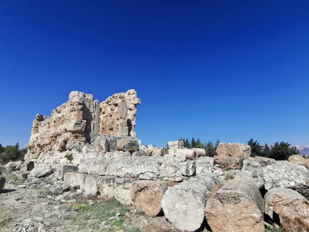
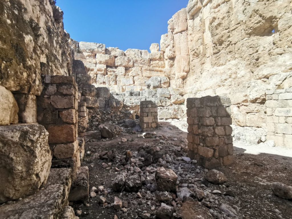
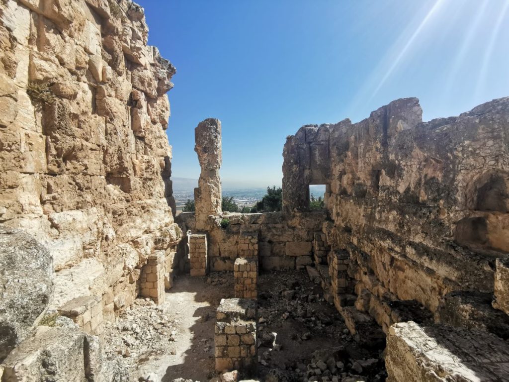
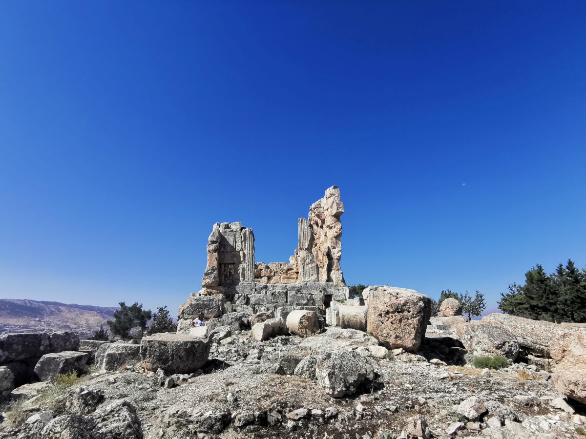
Structure
The site is a large rectangular sanctuary occupying the top of the tell. It is surrounded by a Temenos, and the edifice rests on a massive foundation block and a high podium, opened to the north
The temple follows the Cornithian order, which included a pronaos, a reddish peristyle of six columns in front and eleven columns on the long sides and a cella at the bottom of which rose the platform of an adyton without a crypt.
After a study of its plan and its architectural decoration, the temple seems to derive from a Heliopolitan model. Several authors have noted the age of its design:
P.-L. Gatier (1999-2000, p. 110) mentions the re-use of “decorated blocks of late Hellenistic appearance” in the temple.
L. Nordiguian (2005, p. 91) suggests dating these blocks from the Augustan period.
During the medieval times, the monumental staircase, its podium and its antes were dismantled to make a tower of the cella.
The only inscription found on site was mostly unreadable, thus archeologists couldn’t identify the diety venerated at Majdel Anjar Temple.
Scroll down to enjoy the pictures and to locate the site on the map.
Karim Sokhn
Tour Operator & Tour Guide
References:
https://www.livius.org/articles/place/majdel-anjar/
La vie Religieuse Au Liban Sous L’Empire Romain – Julien Aliquo