Akkar El-Aatika houses the remnants of a medieval era fortress consecutively built, occupied, remodeled and used by successive civilizations over a period of approximately 700 years.
Toponym
The fortress holds several designations in relation to its successive rulers:
“Hosn Ibn Akkar” in relation to its builder Muhriz Ibn Akkar during the Fatimid era.
“Guibelacard” and “Gibelacar” are the fotress’s names given by the Crusaders.
“Al Sayfa” in relation to the feudal family Al Sayfa that controled the fortress uring the Ottoman era.
Location
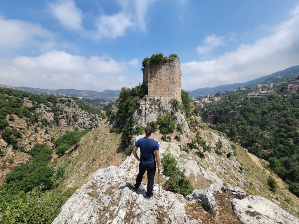
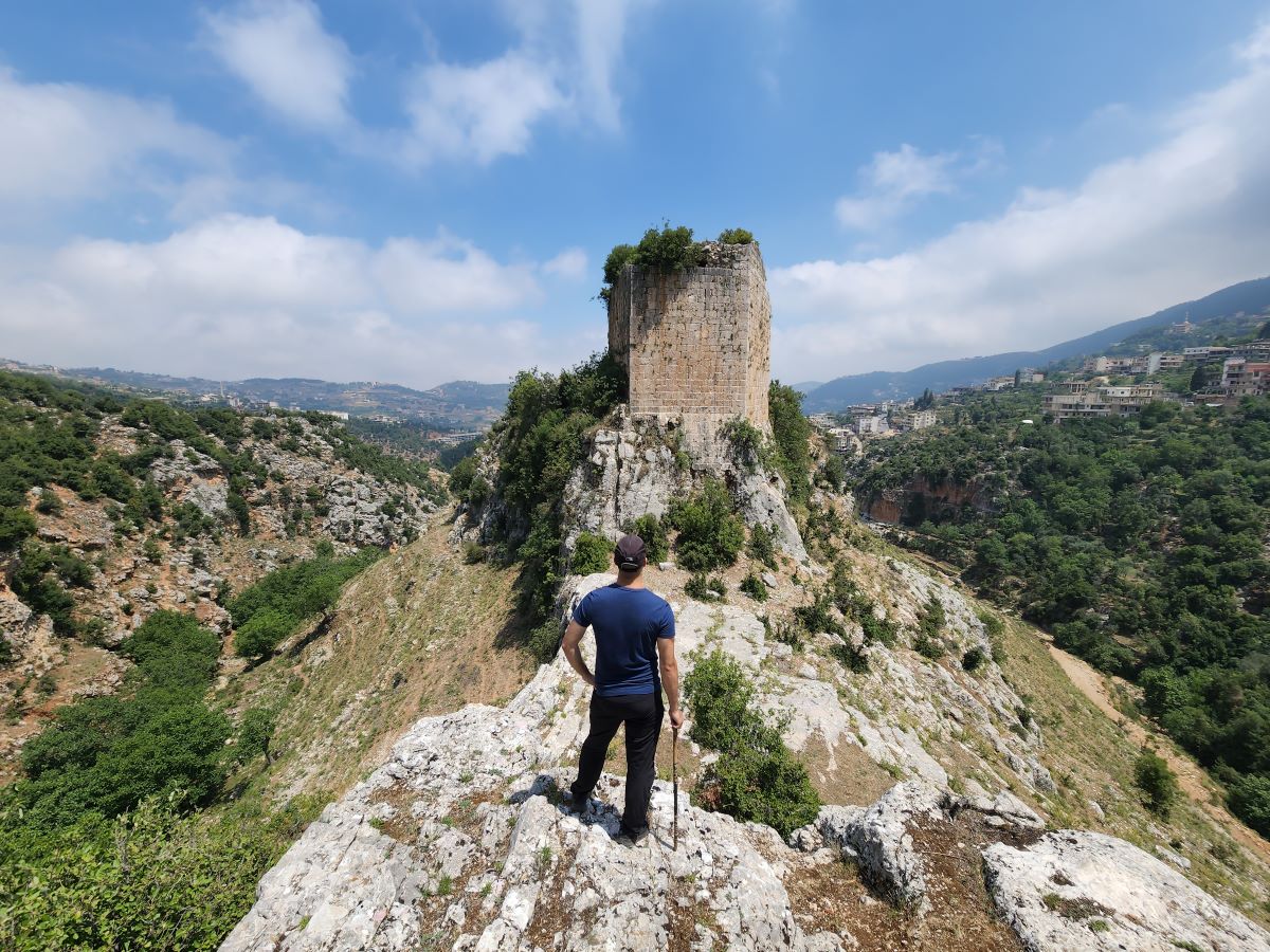
The fortress is erected on an isolated almost inaccessible hill at an altitude of about 700m.
Its location was strategic: defenders were able to control the Homs – Baalbek road and the Tripoli – Bekaa road.
The fortress was able to communicate with its counterparts, most notably the Crac des Chevalier in Syria, by fires which signaled the movements of the enemy.
It requires a 20min uphill hike to reach the fortress, and it is open for public.
Timeline
11th century – around the year 1000, a fortress known as “Hosn Ibn Akkar” (Ibn Akkar fortress) was founded by a certain Muhriz Ibn Akkar and remained into his family’s possession until 1019.
1024 – Following a rebellion against the Fatimid rule, the fortress fell to Salih Ibn Mirdas, the governor of Aleppo and the pre-eminent chieftain of the Banu Kilab tribe and founder of the Mirdasid dynasty.
1033 – The fortress was captured by the governor of Tripoli following the re-establishment of the Fatimid authority.
1094 – The fortress fell to the Seljuk Emir of Damascus Tutush I, and was controlled later on by one of his officers Zahir al-Din Toghteki.
1109 – The fortress was passed to the Crusaders following a treaty with Zahir al-Din Toghteki in light of the fall of Tripoli into the hands of the Crusaders.
1143 – Hosn Ibn Akkar became known as “Guibelacard” as called by the crusaders and was later on mentioned as “Gibelacar” in 1170 in Crusader historical writings. For most of the first half of the 12th century, the fortress was under the control of a large baronial family of the county of Tripoli – the Puylurens family.
1165 – 1167 – at an undetermined date, the fortress fell to Nourel-Din Mahmoud Zengi, a member of the Zengid Turkish dynasty who played an important military role against the Crusaders.
1169 – 1170 – Gibelacar was taken back by the crusaders.
1170 – Gibelacar was mostly destroyed following an earthquake that began on June 29th, 1170 and whose aftershocks lasted until July 24th. The Knights Hospitallers were instructed to restore the fortress by King Amalric of Jerusalem.
13th century – Gibelacar became under the control of Raynouard III de Nephin since his wife Isabelle inherited the fortress from her father Astafort, who was the lord of the Gibelacar. However, because the transfer was done without the approval of Raynouard’s lord, Bohemond IV of Antioch, the latter opposed the move and a civil war ensued. Bohemond took back Gibelacar in 1205 and Raynouard was exiled to Cyprus, where he died.
1271 – The Mamluk sultan Beibars laid siege to the fortress on May 2nd. The defenders capitulated on May 11th and were provided a safe access to Tripoli. Chronicles of that battle desribe how the sultan was able to transfer his heavy seige machinery through the rough terrain that led to the fortress; his army had to cut trees, to break rocks and to flatten the land over a period of approximately 4 days. The fortress fell into decay afterwards.
1520s – The fortress was entrusted to the Sayfa clan for most of the 16th century who rebuilt it. It is known localy as Qalaat Al Sayfa (Al Sayfa fortress).
17th century – the last account of the fortress recalls that it was partly demolished by the Druze emir Fakhraddin II upon his military campaigns in Mount-Lebanon against other fedaul lords.
Structure
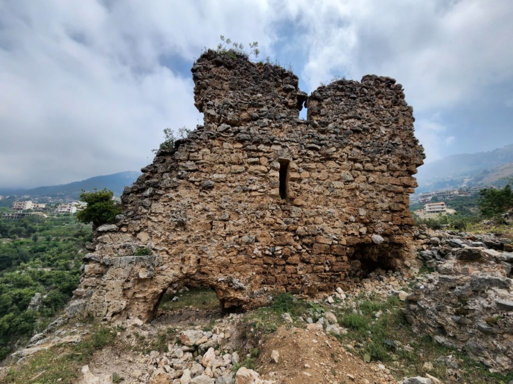
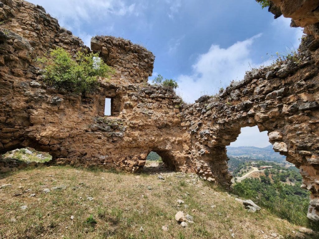
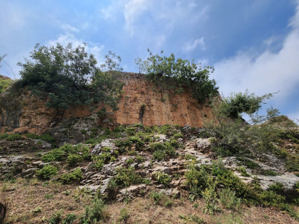
The plateau that forms the base of the castle is 210 meters long from north to south and 70 meters at its widest point. Its enclosure is formed by partly destroyed walls, reinforced by square towers and rectangular projections.
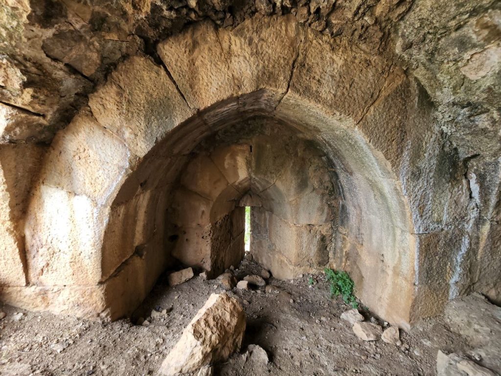
The land slopes is cut about halfway along its length by a ditch which divides the place into a lower court to the north, and an upper court to the south. Both courts houses vaulted rooms, while the upper one has a cisterm.
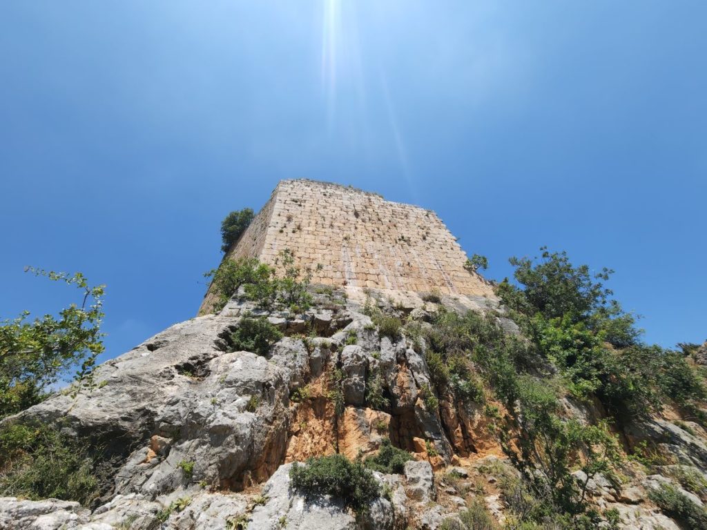
The main attraction is the 13x13m tower which stands on a high rock that dominates the whole site. Its door stands more than 3meters above the ground, reachable through a ladder that the defenders withdrew after having entered the tower.
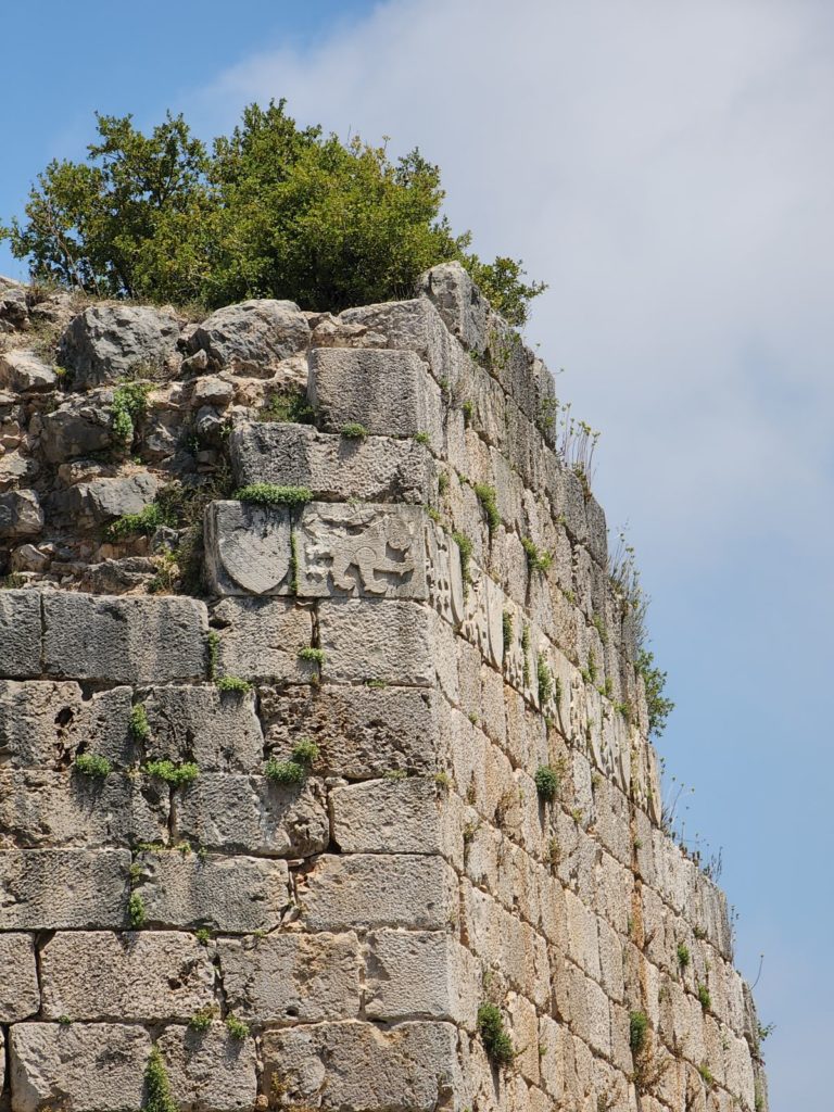
The eastern and southern faces of the tower feature a sculpted frieze of cheetahs and crests, emblem of Sultan Beibars.
Karim Sokhn
Tour Operator & Tour Guide
References:
Les Chateaux des Croises en Terre Sainte III, La Defense du Comte de Tripoli et de la Principaute d’Antioche.