
Ras Nhash village houses the remnants of a 16th century AD military structure.
The village is located north of the promontory of Ras Al Shakaa, which separates the Batroun district to the south from the Koura district to the north.
Historical Background
1517 AD – Following the Ottoman victory over the Mamluks and their conquest of Lebanon, the war-weakened Ottoman authorities appointed/entrusted the administration of each area in Mount Lebanon and the Bekaa to local and foreign tribes, feudal leaders and religious factions.
1558 AD – Sultan Selim II appointed Kurdish Emirs over the Koura district to guard the shores of the area and prevent any risk of future maritime invasion by the Europeans. Consequently, the Kurdish Emirs established a military base in Ras Nhash.
1655 AD – Emir Ismail, son of Emir Musa, who failed to pay his taxes to the sultanate, was hunted down and defeated by the army of Mohamad Pashë Qyprilliu in Al Heri area. Emir Ismail took refuge to the Chouf area and was later on appointed by Ahmad Al Maani as governor of Tyr.
1660 AD – Emir Ismail gets assassinated by Mohamad Pashë Qyprilliu when he travels to Tripoli after receiving an invitation to have a peaceful agreement.
1693 AD – The Kurdish Emirs of Ras Nhash would then fade away after the death of Emir Musa at the hand of the Hamada faction in Ain Kaba’al.
*To note that according to other historical sources, the military structures date back to the Mamluk period, and not the ottomans. These sources are yet to be confirmed.
Structures
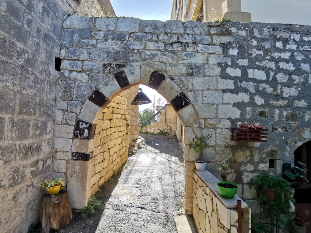
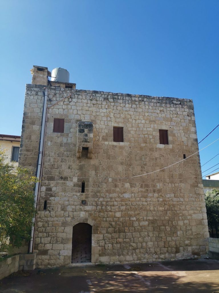
Ras Nhash holds remnants of a once important citadel, and a well preserved tower that overlooks the area.
The Western Gate – one of the remnants of the citadel is the western gate built following the ablaq design (black-and-white stone). This type of design first appeared in the Mamluk structures and was adopted later on by the Ottomans. Once you cross the gate, you will notice on the left side a door that leads you to a wide room where presumably the horses would be kept, or in other cases the room would be used as a storage space or a guarding post.
The court of the citadel, as well as its other sections have been dismantled over time, and one can see the stones of the citadel reused in the construction of nearby houses.
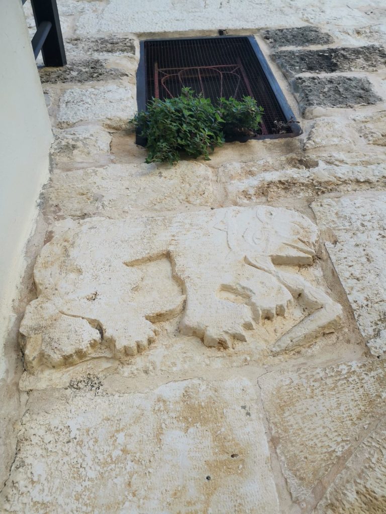
The Lion Reliefs – on the left side of the citadel’s gate, and just before you reach it, you can see 2 lion reliefs, symbol of power and protection. This symbol date back to the ancient times and was adopted by different civilizations – it would be used in abundance on the gates of the fortresses and palaces in Lebanon between the Mamluk and the Ottoman era.
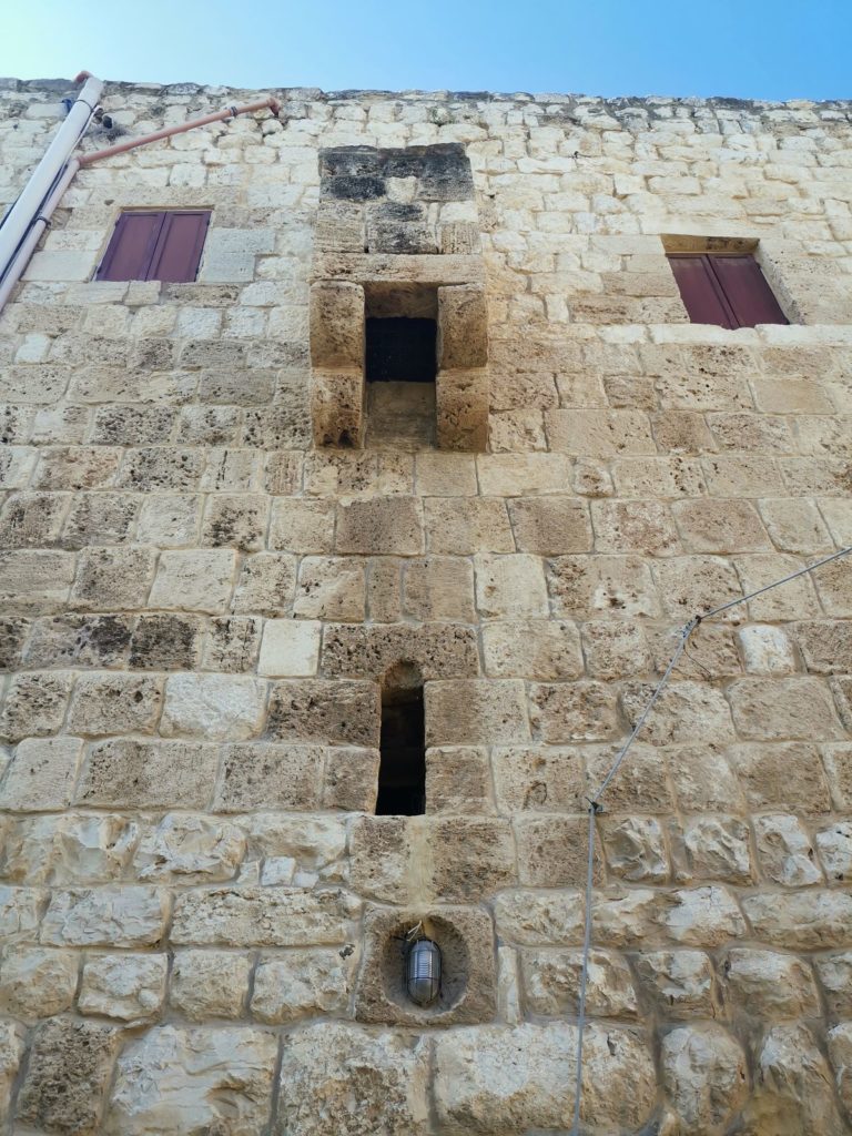
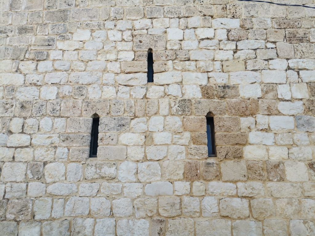
The Tower – the best preserved monument of the citadel is the defensive tower, a 3 story building that was used to watch the coast line and the surrounding areas. One can see the corbels of its machicolated battlements and the arrow slit openings.
Karim Sokhn
Tour Operator & Tour Guide
References:
Akhbar Al A’ayan Fi Jabal Loubnan, Part 1, Tannous El Chidiac, 1895
PROVINCIAL LEADERSHIPS IN SYRIA, 1575-1650 Abdul-Rahim Abu-Husayn